To better understand the interaction between weather and ground conditions, several boreholes have been installed around Longyearbyen as part of the PermaMeteoCommunity and ThawingLYR projects. These boreholes allow to monitor soil temperature, soil moisture and freezing state in different depth and help to understand and predict changes throughout seasons and as climate warms.
Please see map below for the location of the boreholes in Longyeardalen and information on what parameters are observed.
What is a Borehole?
Boreholes are drilled into the ground to depths of 3 to 7 m. Each borehole contains a pipe that is equipped with temperature sensors in different depth. The information from the borehole is essential for understanding soil conditions and to investigate how permafrost responds to temperature changes in the Arctic environment.
-

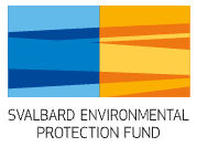
Borehole with thermistor string (without cover).
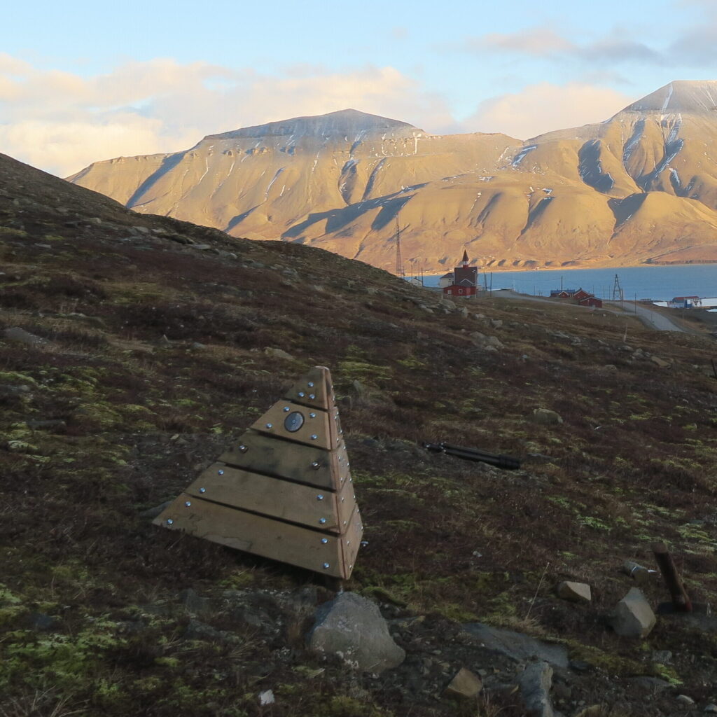
with wooden pyramid for cover.
Temperature Monitoring in the Boreholes
Temperature measurements in the boreholes are recorded using TNode thermistor strings from GeoPrecision. Thermistor strings are long cables with temperature sensors spaced along their length. The topmost sensor, located at the surface level (0 cm), measures the air temperature in a metal tube positioned at ground level. The sensors deeper in the ground measure the temperature of the soil at different depths.
The sensors are powered by a battery, allowing for up to five years of continuous operation. All data from the boreholes is transmitted digitally to data loggers. The sensors have a resolution of 0.01°C and are accurate within ±0.1°C from -5 to +50°C, and ±0.5°C from -40 to +85°C.
Measuring Soil Moisture Conditions
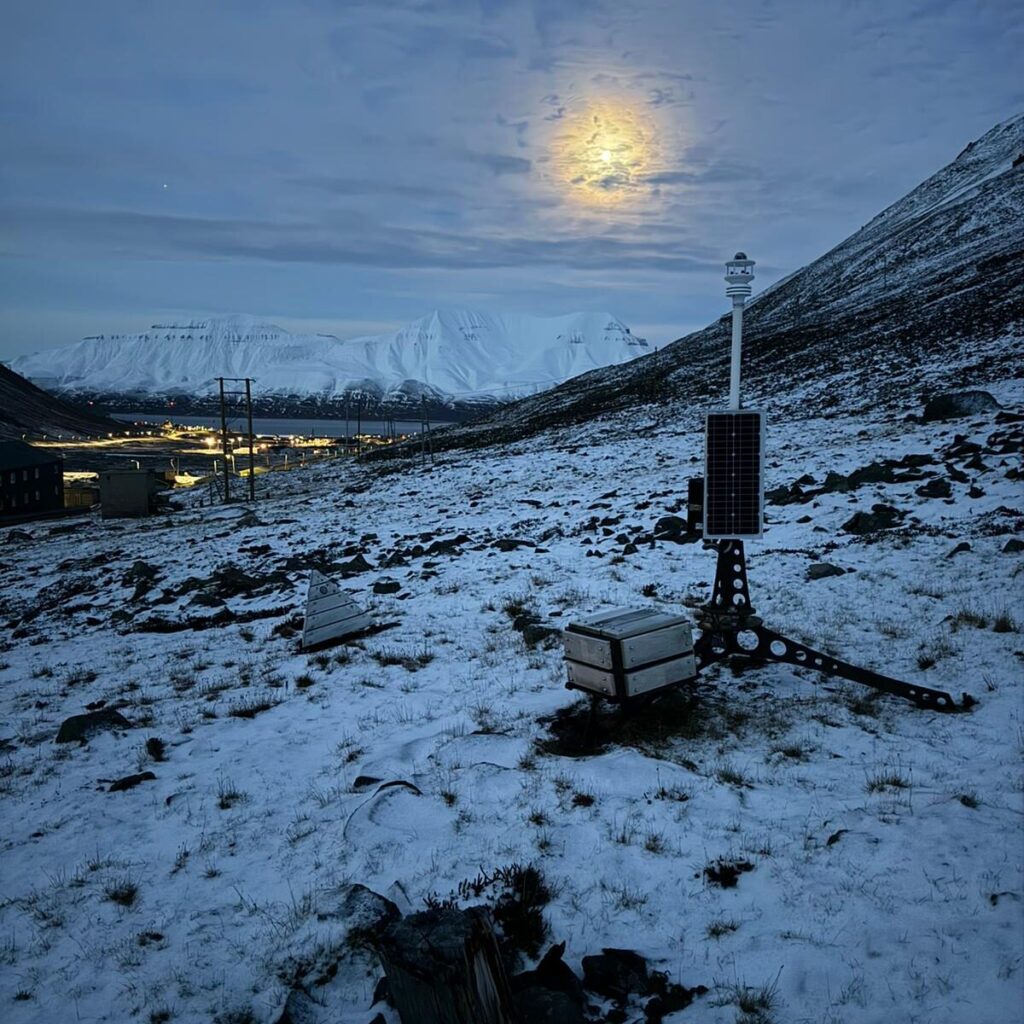
In addition to temperature, the water content of the soil is measured close to three of the boreholes. To do this, a hole is dug in the permafrost and the sensors are installed directly in the soil before the hole is refilled. Three of these measuring points are located about 20 metres away from the boreholes.
The sensors measure the so called “calibrated counts,” from which the amount of water per kilogram of soil can be calculated. Furthermore, the state (frozen or not frozen) of the soil is monitored by measuring its electrical conductivity. This is based on the knowledge that liquid water has high conductivity compared to the low conductivity of ice and dry soil. This is especially valuable in Longyearbyen, where the permafrost contains saline marine clays. A high salinity in the ground lowers the soil’s freezing point, similar to how salt lowers the freezing point of water. Although marine clay is present in some parts of Longyearbyen, it is not directly present where the water content is measured in our project.
Why Monitor the Ground Conditions?
Longyearbyen’s steep terrain causes large local variations in weather, especially in temperature and precipitation. Permafrost and the “active layer” (the top layer of soil that thaws and freezes seasonally) are closely tied to these weather factors. Monitoring both the atmosphere and the soil helps to understand and forecast conditions that can lead to debris flows and active layer detachment slides. These hazards become more likely as climate change brings longer, wetter, and warmer autumns.